Hempstead County, Arkansas | |
|---|---|
|
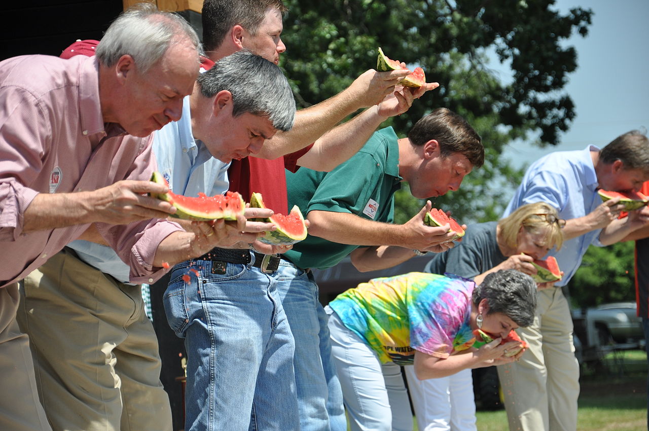
Clockwise from top: Hempstead County Courthouse in Hope, Bill Clinton Birthplace, Politicians at the Hope Watermelon Festival, the former Hempstead County Courthouse | |
 Location within the U.S. state of Arkansas | |
| Coordinates: 33°44′07″N 93°40′06″W / 33.7353°N 93.66844°W / 33.7353; -93.66844 | |
| Country |  United States United States |
| State |  Arkansas Arkansas |
| Founded | December 15, 1818 |
| Named after | Edward Hempstead |
| Seat | Hope |
| Largest city | Hope |
| Area | |
• Total | 741 sq mi (1,920 km2) |
| • Land | 728 sq mi (1,890 km2) |
| • Water | 14 sq mi (36 km2) 1.8% |
| Population (2020) | |
• Total | 20,065 |
• Estimate (2024) | 19,105  |
| • Density | 27.6/sq mi (10.6/km2) |
| Time zone | UTC−6 (Central) |
| • Summer (DST) | UTC−5 (CDT) |
| Congressional district | 4th |
| Website | hempsteadcountyar.com |
.jpg/1280px-Hope_May_2018_11_(Farmers_Bank_&_Trust).jpg)
.jpg/1280px-Hope_May_2018_26_(Hempstead_County_Courthouse).jpg)
.jpg/1280px-President_William_Jefferson_Clinton_Birthplace_Home_National_Historic_Site_May_2018_3_(Bill_Clinton_Birthplace).jpg)
Hempstead County is a county located in the U.S. state of Arkansas. As of the 2020 census, the population was 20,065,[1] down from 22,609 at the 2010 census.[2] The county seat is Hope.[3] Hempstead County is Arkansas's fourth county, formed on December 15, 1818, alongside Clark and Pulaski counties. The county is named for Edward Hempstead, a delegate to the U.S. Congress from the Missouri Territory, which included present-day Arkansas at the time.[4] It is an alcohol prohibition or dry county.
The 42nd United States President, Bill Clinton, who served from 1993 to 2001, was born in the county seat of Hope on August 19, 1946.[5] As of 2026, Clinton is the only President to have been born in Arkansas.
Geography
According to the U.S. Census Bureau, the county has a total area of 741 square miles (1,920 km2), of which 728 square miles (1,890 km2) is land and 14 square miles (36 km2) (1.8%) is water.[6] Hempstead County is alternately considered as part of the greater regions of South Arkansas or Southwest Arkansas.
Major highways
.svg/1280px-I-30_(AR).svg.png)


.jpg)
.jpg)
.jpg)
.svg)
Adjacent counties
- Pike County (north)
- Nevada County (east)
- Lafayette County (south)
- Miller County (southwest)
- Little River County (west)
- Howard County (northwest)
Demographics
| Census | Pop. | Note | %± |
|---|---|---|---|
| 1830 | 2,512 | — | |
| 1840 | 4,921 | 95.9% | |
| 1850 | 7,672 | 55.9% | |
| 1860 | 13,989 | 82.3% | |
| 1870 | 13,768 | −1.6% | |
| 1880 | 19,015 | 38.1% | |
| 1890 | 22,796 | 19.9% | |
| 1900 | 24,101 | 5.7% | |
| 1910 | 28,285 | 17.4% | |
| 1920 | 31,602 | 11.7% | |
| 1930 | 30,847 | −2.4% | |
| 1940 | 32,770 | 6.2% | |
| 1950 | 25,080 | −23.5% | |
| 1960 | 19,661 | −21.6% | |
| 1970 | 19,308 | −1.8% | |
| 1980 | 23,635 | 22.4% | |
| 1990 | 21,621 | −8.5% | |
| 2000 | 23,587 | 9.1% | |
| 2010 | 22,609 | −4.1% | |
| 2020 | 20,065 | −11.3% | |
| 2024 (est.) | 19,015 | [7] | −5.2% |
| U.S. Decennial Census[8] 1790–1960[9] 1900–1990[10] 1990–2000[11] 2010–2020[2][1] | |||
2020 census
As of the 2020 census, the county had a population of 20,065. The median age was 40.3 years. 25.1% of residents were under the age of 18 and 18.5% of residents were 65 years of age or older. For every 100 females there were 93.2 males, and for every 100 females age 18 and over there were 89.9 males age 18 and over.[12][13]
The racial makeup of the county was 54.9% White, 28.3% Black or African American, 0.7% American Indian and Alaska Native, 0.5% Asian, less than 0.1% Native Hawaiian and Pacific Islander, 8.9% from some other race, and 6.7% from two or more races. Hispanic or Latino residents of any race comprised 14.7% of the population.[13]
44.1% of residents lived in urban areas, while 55.9% lived in rural areas.[14]
There were 7,992 households in the county, of which 31.6% had children under the age of 18 living in them. Of all households, 43.2% were married-couple households, 19.0% were households with a male householder and no spouse or partner present, and 32.2% were households with a female householder and no spouse or partner present. About 29.5% of all households were made up of individuals and 13.1% had someone living alone who was 65 years of age or older.[12]
There were 9,601 housing units, of which 16.8% were vacant. Among occupied housing units, 67.3% were owner-occupied and 32.7% were renter-occupied. The homeowner vacancy rate was 1.9% and the rental vacancy rate was 12.2%.[12]
2000 census
As of the 2000 census,[15] there were 23,587 people, 8,959 households, and 6,378 families residing in the county. The population density was 32 inhabitants per square mile (12/km2). There were 10,178 housing units at an average density of 14 per square mile (5.4/km2). The racial makeup of the county was 63.28% White, 30.36% Black or African American, 0.42% Native American, 0.17% Asian, 0.02% Pacific Islander, 4.17% from other races, and 1.59% from two or more races. 8.25% of the population were Hispanic or Latino of any race.
There were 8,959 households, out of which 33.40% had children under the age of 18 living with them, 51.40% were married couples living together, 15.30% had a female householder with no husband present, and 28.80% were non-families. 25.50% of all households were made up of individuals, and 11.70% had someone living alone who was 65 years of age or older. The average household size was 2.60 and the average family size was 3.09.
In the county, the population was spread out, with 27.30% under the age of 18, 9.60% from 18 to 24, 27.20% from 25 to 44, 21.70% from 45 to 64, and 14.10% who were 65 years of age or older. The median age was 35 years. For every 100 females, there were 93.70 males. For every 100 females age 18 and over, there were 89.70 males.
The median income for a household in the county was $28,622, and the median income for a family was $34,082. Males had a median income of $25,830 versus $17,383 for females. The per capita income for the county was $14,103. About 16.00% of families and 20.30% of the population were below the poverty line, including 29.20% of those under age 18 and 16.70% of those age 65 or over.
Government
Government
The county government is a constitutional body granted specific powers by the Constitution of Arkansas and the Arkansas Code. The quorum court is the legislative branch of the county government and controls all spending and revenue collection. Representatives are called justices of the peace and are elected from county districts every even-numbered year. The number of districts in a county vary from nine to fifteen, and district boundaries are drawn by the county election commission. The Hempstead County Quorum Court has eleven members. Presiding over quorum court meetings is the county judge, who serves as the chief operating officer of the county. The county judge is elected at-large and does not vote in quorum court business, although capable of vetoing quorum court decisions.[16][17]
| Position | Officeholder | Party |
|---|---|---|
| County Judge | Jerry T. Crane | Republican |
| County Clerk | Karen Smith | Republican |
| Circuit Clerk | Gail Wolfengarger | Democratic |
| Sheriff/Collector | James Singleton | Democratic |
| Treasurer | Judy Lee Flowers | Democratic |
| Assessor | Renee Gilbert | Republican |
| Coroner | David W. Peters | Republican |
The composition of the Quorum Court following the 2024 elections is 7 Republicans and 3 Democrats, with one seat vacant due to no filings. Justices of the Peace (members) of the Quorum Court following the elections are:[18][20][21]
- District 1: James Griffin (D) of Hope
- District 2: (seat currently Vacant)
- District 3: Doris Brown (D) of Hope
- District 4: Ed B. Darling (R) of Hope
- District 5: Victor Ford (R)
- District 6: Troy K. Lerew (R) of Hope (seat currently Vacant)
- District 7: Steve Atchley (R) of Hope
- District 8: C. David Clayton (R) of Hope
- District 9: Jessie Henry (D)
- District 10: Jay Lathrop (R) of Nashville
- District 11: B. Keith Steed (R)
Additionally, the townships of Hempstead County are entitled to elect their own respective constables, as set forth by the Constitution of Arkansas. Constables are largely of historical significance as they were used to keep the peace in rural areas when travel was more difficult.[22] The township constables as of the 2024 elections are:[21]
- Bodcaw: David Keith Cummings (R)
- Bois D'Arc: Maurice Henry (D)
- Deroan: Reyn Brown (R)
- Garland: Randall Hatfield (R)
- Ozan: Becky Medlen-Billings (R)
- Spring Hill: Jimmy F. Singleton (R)
- Wallaceburg: Thomas Luke Everett (R)
- Watercreek: Frankie Ingersoll (R)
Politics
Starting in 2008, voters of Hempstead County have shifted to the political right in US presidential elections. That said, the city of Hope is still very Democratic as of the 2024 election.[23]
| Year | Republican | Democratic | Third party(ies) | |||
|---|---|---|---|---|---|---|
| № | % | № | % | № | % | |
| 1896 | 1,203 | 39.26% | 1,832 | 59.79% | 29 | 0.95% |
| 1900 | 1,330 | 49.11% | 1,352 | 49.93% | 26 | 0.96% |
| 1904 | 1,477 | 49.41% | 1,410 | 47.17% | 102 | 3.41% |
| 1908 | 1,346 | 41.68% | 1,779 | 55.09% | 104 | 3.22% |
| 1912 | 836 | 31.63% | 1,247 | 47.18% | 560 | 21.19% |
| 1916 | 1,238 | 37.05% | 2,103 | 62.95% | 0 | 0.00% |
| 1920 | 1,754 | 43.65% | 2,239 | 55.72% | 25 | 0.62% |
| 1924 | 715 | 30.37% | 1,459 | 61.98% | 180 | 7.65% |
| 1928 | 886 | 30.25% | 2,038 | 69.58% | 5 | 0.17% |
| 1932 | 317 | 10.03% | 2,840 | 89.90% | 2 | 0.06% |
| 1936 | 190 | 7.24% | 2,431 | 92.68% | 2 | 0.08% |
| 1940 | 415 | 12.85% | 2,814 | 87.15% | 0 | 0.00% |
| 1944 | 624 | 22.37% | 2,157 | 77.34% | 8 | 0.29% |
| 1948 | 386 | 12.58% | 1,683 | 54.84% | 1,000 | 32.58% |
| 1952 | 2,115 | 43.28% | 2,771 | 56.70% | 1 | 0.02% |
| 1956 | 2,227 | 44.57% | 2,694 | 53.91% | 76 | 1.52% |
| 1960 | 1,948 | 40.93% | 2,596 | 54.55% | 215 | 4.52% |
| 1964 | 2,493 | 42.32% | 3,355 | 56.95% | 43 | 0.73% |
| 1968 | 1,783 | 24.62% | 2,322 | 32.07% | 3,136 | 43.31% |
| 1972 | 4,963 | 70.80% | 2,047 | 29.20% | 0 | 0.00% |
| 1976 | 2,859 | 34.63% | 5,397 | 65.37% | 0 | 0.00% |
| 1980 | 3,852 | 44.65% | 4,671 | 54.14% | 105 | 1.22% |
| 1984 | 4,904 | 59.31% | 3,327 | 40.24% | 37 | 0.45% |
| 1988 | 3,938 | 50.49% | 3,841 | 49.25% | 20 | 0.26% |
| 1992 | 2,387 | 26.75% | 5,476 | 61.38% | 1,059 | 11.87% |
| 1996 | 2,021 | 26.76% | 4,983 | 65.99% | 547 | 7.24% |
| 2000 | 3,257 | 44.68% | 3,937 | 54.01% | 95 | 1.30% |
| 2004 | 3,580 | 48.04% | 3,817 | 51.22% | 55 | 0.74% |
| 2008 | 4,273 | 58.14% | 2,869 | 39.04% | 207 | 2.82% |
| 2012 | 4,284 | 61.90% | 2,468 | 35.66% | 169 | 2.44% |
| 2016 | 4,401 | 62.43% | 2,377 | 33.72% | 271 | 3.84% |
| 2020 | 4,470 | 65.27% | 2,138 | 31.22% | 240 | 3.50% |
| 2024 | 4,193 | 68.86% | 1,776 | 29.17% | 120 | 1.97% |
Communities


Cities
- Blevins
- Hope (county seat)
- Washington
Towns
Census-designated place
Unincorporated communities
Townships
Townships in Arkansas are the divisions of a county. Each township includes unincorporated areas; some may have incorporated cities or towns within part of their boundaries. Arkansas townships have limited purposes in modern times. However, the United States census does list Arkansas population based on townships (sometimes referred to as "county subdivisions" or "minor civil divisions"). Townships are also of value for historical purposes in terms of genealogical research. Each town or city is within one or more townships in an Arkansas county based on census maps and publications. The townships of Hempstead County are listed below; listed in parentheses are the cities, towns, and/or census-designated places that are fully or partially inside the township. [25][26]
See also
- Arkadelphia Marl
- List of lakes of Hempstead County, Arkansas
- Marlbrook Marl
- National Register of Historic Places listings in Hempstead County, Arkansas
References
- ^ a b "QuickFacts". U.S. Census Bureau. April 1, 2020. Retrieved March 21, 2022.
- ^ a b "State & County QuickFacts". United States Census Bureau. Archived from the original on June 7, 2011. Retrieved May 21, 2014.
- ^ "Find a County". National Association of Counties. Archived from the original on May 31, 2011. Retrieved June 7, 2011.
- ^ Gannett, Henry (1905). The Origin of Certain Place Names in the United States. Govt. Print. Off. pp. 154.
- ^ "William J. Clinton". The White House. Retrieved July 22, 2022.
- ^ "2010 Census Gazetteer Files". United States Census Bureau. August 22, 2012. Retrieved August 26, 2015.
- ^ "Annual Estimates of the Resident Population for Counties: April 1, 2020 to July 1, 2023". United States Census Bureau. Retrieved March 30, 2024.
- ^ "U.S. Decennial Census". United States Census Bureau. Retrieved August 26, 2015.
- ^ "Historical Census Browser". University of Virginia Library. Retrieved August 26, 2015.
- ^ Forstall, Richard L., ed. (March 27, 1995). "Population of Counties by Decennial Census: 1900 to 1990". United States Census Bureau. Retrieved August 26, 2015.
- ^ "Census 2000 PHC-T-4. Ranking Tables for Counties: 1990 and 2000" (PDF). United States Census Bureau. April 2, 2001. Archived (PDF) from the original on March 27, 2010. Retrieved August 26, 2015.
- ^ a b c "2020 Decennial Census Demographic Profile (DP1)". United States Census Bureau. 2021. Retrieved December 27, 2025.
- ^ a b "2020 Decennial Census Redistricting Data (Public Law 94-171)". United States Census Bureau. 2021. Retrieved December 27, 2025.
- ^ "2020 Decennial Census Demographic and Housing Characteristics (DHC)". United States Census Bureau. 2023. Retrieved December 27, 2025.
- ^ "U.S. Census website". United States Census Bureau. Retrieved May 14, 2011.
- ^ "Quorum Courts". Encyclopedia of Arkansas. Retrieved April 28, 2025.
- ^ "Office of County Judge". Encyclopedia of Arkansas. Retrieved April 28, 2025.
- ^ a b "Hempstead | Association of Arkansas Counties". www.arcounties.org. Retrieved April 28, 2025.
- ^ "2022 General Election: County, District Officials" (PDF). www.arcounties.org. Association of Arkansas Counties. June 27, 2022.
- ^ "Justice of the Peace | Hempstead County Arkansas". Retrieved April 28, 2025.
- ^ a b "Hempstead County, Arkansas, elections, 2024". Ballotpedia. Retrieved April 28, 2025.
- ^ "What is a Constable?". What is a Constable?. Retrieved April 28, 2025.
- ^ Park, Alice; Smart, Charlie; Taylor, Rumsey; Watkins, Miles (February 2, 2021). "An Extremely Detailed Map of the 2020 Election". The New York Times. ISSN 0362-4331. Retrieved April 15, 2021.
- ^ "Dave Leip's Atlas of U.S. Presidential Elections". Retrieved November 18, 2016.
- ^ 2011 Boundary and Annexation Survey (BAS): Hempstead County, AR (PDF) (Map). U. S. Census Bureau. Archived from the original (PDF) on October 19, 2012. Retrieved August 24, 2011.
- ^ "Arkansas: 2010 Census Block Maps - County Subdivision". United States Census Bureau. Retrieved May 28, 2014.
External links
- Official website
33°44′07″N 93°40′06″W / 33.7353°N 93.66844°W / 33.7353; -93.66844
