Randowtal
Randowtal | |
|---|---|
Location of Randowtal within Uckermark district 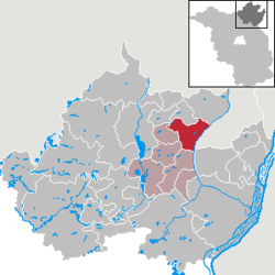 | |
 Location of Randowtal | |
  Randowtal  Randowtal | |
| Coordinates: 53°17′53″N14°02′00″E / 53.2980°N 14.0333°E / 53.2980; 14.0333 | |
| Country | Germany |
| State | Brandenburg |
| District | Uckermark |
| Municipal assoc. | Gramzow |
| Government | |
| • Mayor(2024–29) | Axel Krumrey[1] |
| Area | |
• Total | 63.71 km2 (24.60 sq mi) |
| Elevation | 55 m (180 ft) |
| Population (2023-12-31)[2] | |
• Total | 896 |
| • Density | 14.1/km2 (36.4/sq mi) |
| Time zone | UTC+01:00 (CET) |
| • Summer (DST) | UTC+02:00 (CEST) |
| Postal codes | 17291 |
| Dialling codes | 039857, 039862 |
| Vehicle registration | UM |
| Website | www.amtgramzow.de |
Randowtal is a municipality in the Uckermark district, in Brandenburg, Germany.
Demography

Randowtal: Population development within the current boundaries (2017)[3] | ||||||||||||||||||||||||||||||||||||||||||||||||||||||||||||||||||||||||||||||||||||||||||||||||||||||||||||||||||||||||||||||||||||||
|
|
| ||||||||||||||||||||||||||||||||||||||||||||||||||||||||||||||||||||||||||||||||||||||||||||||||||||||||||||||||||||||||||||||||||||
People
- Ernst Schlange (1888-1947), German politician and landowner
References
- ^Landkreis Uckermark Wahl der Bürgermeisterin / des Bürgermeisters. Retrieved 10 July 2024.
- ^"Alle politisch selbständigen Gemeinden mit ausgewählten Merkmalen am 31.12.2023" (in German). Federal Statistical Office of Germany. 28 October 2024. Retrieved 16 November 2024.
- ^Detailed data sources are to be found in the Wikimedia Commons.Population Projection Brandenburg at Wikimedia Commons
![]() Media related to Randowtal at Wikimedia Commons
Media related to Randowtal at Wikimedia Commons
 | This Brandenburg location article is a stub. You can help Wikipedia by adding missing information. |
